
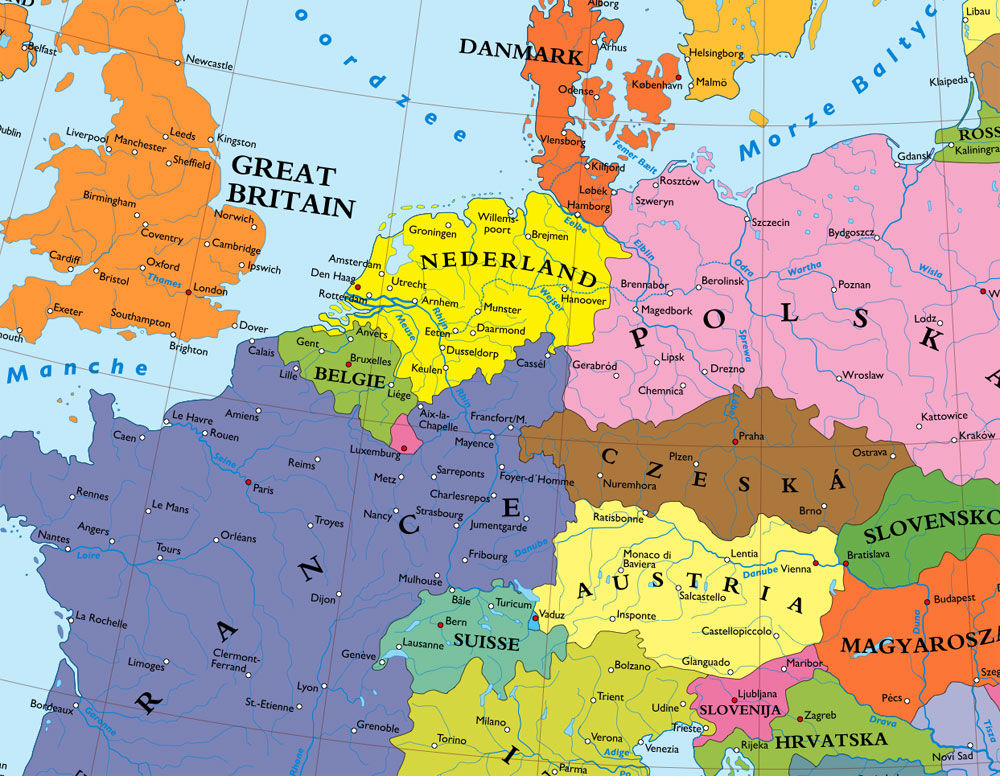
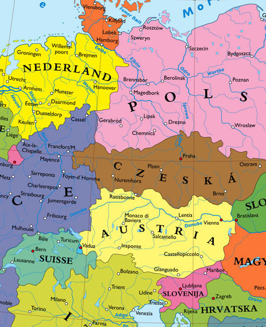
What is this cartographic madness? Hanover part of the Netherlands? Kassel ruled by France? Nuremburg part of a Bohemia that reaches to the Frankfurt suburbs? Hamburg in Denmark? Regensburg on the Austro-Czech border? I came across the company Kalimedia in an article from Die Zeit a month or two ago and discovered their map of a Europe without a Germany. Believe it or not, there were plans of one sort or another to achieve similar results at the end of the Second World War. The major plan for the dissection of Germany was merely a creation of Nazi propaganda, and while the vaguely similar Morgenthau Plandid exist, it was soon shelved once its impracticality became obvious.
The Bakker-Schut Plan, meanwhile, was a Dutch proposal for the annexation of several German towns, and perhaps even a number of German cities. German natives would be expelled, except for those who spoke the Low Franconian dialect, who would be forcibly dutchified. They even came up with a list of new Dutch names for German cities: c.f. the post at Strange Maps on “Eastland, Our Land: Dutch Dreams of Expansion at Germany’s Expense”.
SEPTEMBER 14, 2008 6:20 PM | LINK | 16 COMMENTS »
No comments:
Post a Comment